Mapping the Deradicalization and Prevention Landscape in Germany
Keshif applied its data-visualization technology to develop a dynamic, analytically powerful, and customized platform for visual presentation and analysis of over 800 locally funded initiatives focusing on prevention, de-radicalization, and disengagement from extremist groups and ideology in Germany.
 |  |
|
|
|
|


Impact
IKG and its partners implemented a large-scale survey to map out and evaluate local prevention initiatives across Germany. Using Keshif's interactive visual dashboards, government, research institutions, and local community organizations can gain a better understanding of the landscape for prevention and deradicalization from extremist ideology. They can access information about individual local initiatives, and interactively query the dataset to reveal trends in geographical distribution, funding resources, applied methods, target demographics, and more.
800+
INITIATIVES MAPPED
40+
QUESTIONS COVERED
2
LANGUAGES SUPPORTED
Visual Exploration & Discovery
Discover our tech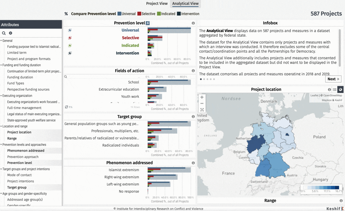
Access analytical dashboards customized to enable overview analysis and exploration of 40+ questions for all initiatives and also show details on individual initiatives.
Understand and analyze geographic distributions of the 800+ local initiatives using rich interactive point-cluster maps.
Navigate data and trends per state and district with maps that can provide two levels of detail on demand.
Enable the public to author new dashboards by easy drag and drop interfaces.

Services
View our servicesVisual Data Analytics and Dashboarding
We created thematic and explorative dashboards that match the MAPEX’s methodology and enable authoring for more in-depth exploration of the data.
Data Preparation
We prepared data processing scripts to transform raw survey data to match the project methodology, data privacy, and analysis goals. We also created tools for data extracts for interactive dashboarding.
Web Design and Development
Our web design reflects the IKG branding requirements and enables configuration of the dashboards and easy embedding on the external project website. The dashboard is fully translated into both German and English to make it accessible to global audiences.